
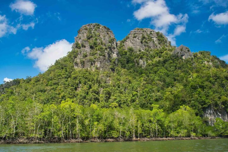
Langkawi is an island of contrasts. While certain areas—like the busy town of Kuah, with its duty-free shops and ferry terminal—might not appeal to every traveller seeking a quiet escape, there is another side to this Malaysian archipelago that completely rewrites your sense of time and place. For us, that revelation came not in the commercial centre, but on the quiet northern roads, somewhere between a cascading waterfall and a shoreline that looks out toward another country.
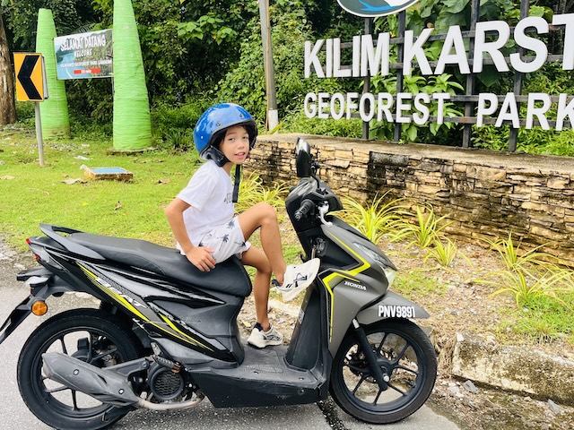
Biking around the island
What struck me most wasn’t just the scenery, though the scenery is genuinely extraordinary. It was the realization that beneath the surface of this island—literally beneath our feet—lies a story so ancient it makes human history feel like a fleeting breath. Langkawi’s rock formations are estimated to be over 550 million years old, making them some of the oldest in Southeast Asia.
Leonardo, at eight, understood this better than I did. “So the island is older than the dinosaurs?” he asked, as we wound along the northern roads. Much older, I told him. Older than trees. Older than almost anything that has ever lived.
A Journey Through Deep Time
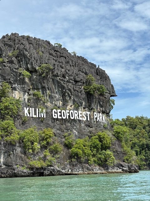
Limestone cliffs with the Kilim Geoforest Park sign in Langkawi
The Langkawi UNESCO Global Geopark isn’t a single place you visit with a ticket booth and a turnstile. It’s a designation that covers the entire archipelago—99 islands, each with its own character, though only a few are inhabited. The Geopark was recognized by UNESCO in 2007, becoming the 52nd member of the Global Geoparks Network and the first in Southeast Asia. What earned it that status wasn’t just the beauty of the place, but the completeness of its geological record: the best-exposed and most complete Palaeozoic sedimentary sequence in Malaysia, spanning from the Cambrian to the Permian period.
We were driving across the remains of an ancient supercontinent, the Sibumasu Block, which broke away from Gondwanaland and drifted northward to eventually collide with other landmasses and form the Southeast Asian mainland we know today. It is the kind of fact that makes you grip the steering wheel a little tighter, as if the road itself might suddenly remind you of its immense age.
Temurun Waterfall: Where the Earth Tells Its Story
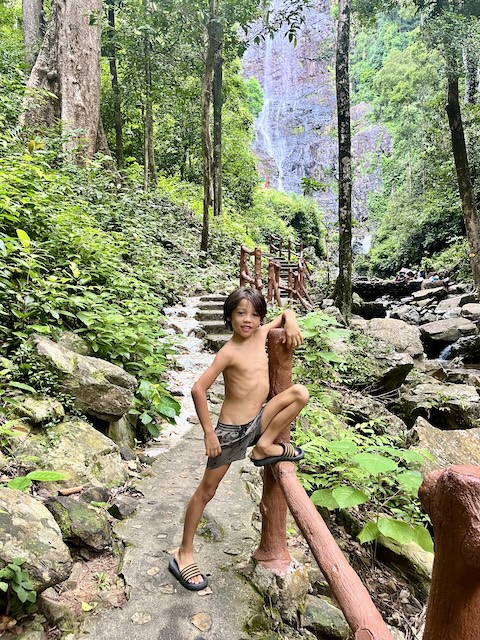
Adventure behold
We drove toward the northwest, following the road toward Datai. Our first stop was Temurun Waterfall, tucked inside the Machinchang Cambrian Geoforest Park. The waterfall cascades over three tiers, one of the tallest on the island, and the walk from the parking area is short but steep—slippery steps, jungle sounds, the sense of leaving the road behind entirely.
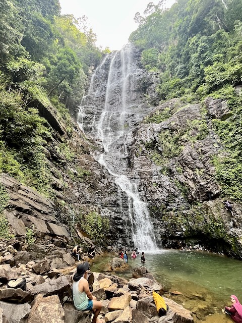
Temurun Waterfall
We decided to swim. The water was cold—genuinely, bracingly cold—but Leonardo loved it so much that he refused to get out. He floated on his back, looking up at the cascade, letting the water carry him in slow circles. I stood at the edge, watching him, feeling the particular stillness that settles over a place when you know it has been falling like this for longer than human memory. The cold was part of the experience, a reminder that this water came from somewhere deep in the earth, filtered through rock that has been here for half a billion years.
What makes Temurun remarkable isn’t just its height. It’s the rock it falls over. The Machinchang Formation is Cambrian sandstone, the oldest rock unit in the region, and the landscape it creates—the peaks, the cliffs, the waterfalls—is the result of 550 million years of geological patience.
Pasir Tengkorak: A Beach with a View to Another World
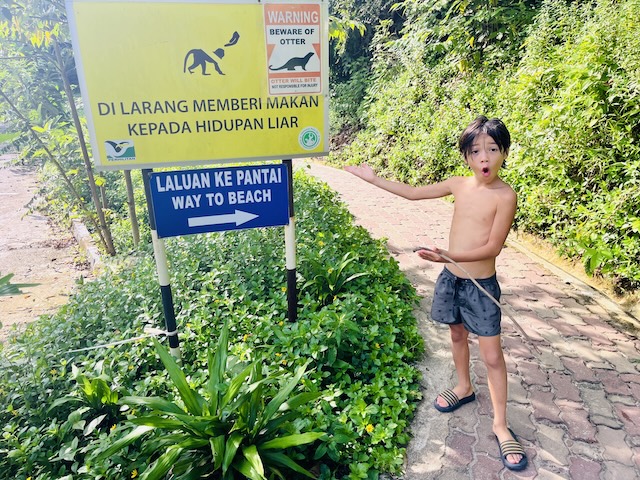
Leonardo along the path to Pasir Tengkorak
From Temurun, we continued toward Pasir Tengkorak, the beach whose name translates to “Skull Beach.” The legends say the name comes from bodies washed ashore after storms, or from victims of pirates who once roamed these waters. On the day we visited, the beach was quiet—a small curve of sand, shaded by trees, the water clear and calm. And there, across the Andaman Sea, was Thailand. Koh Tarutao, clearly visible, less than five kilometers away.
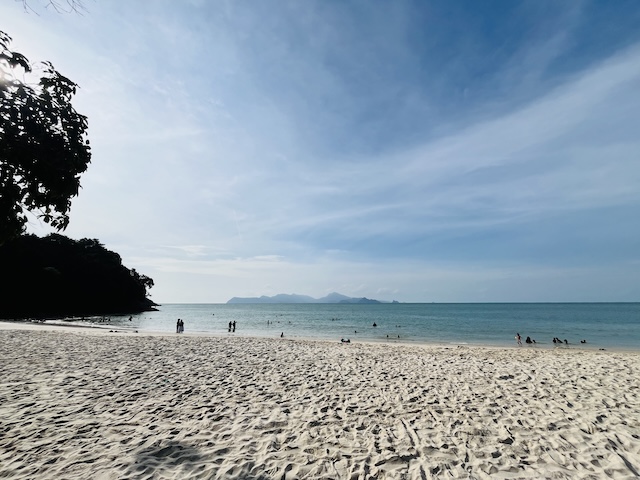
Skull Beach with Tarutao in the distance
Standing on that beach, with Leonardo beside me, I felt the strange intimacy of geography. Here was Malaysia. There was Thailand. Between us, a stretch of sea that has carried fishermen and traders and, yes, pirates for centuries. The Geopark doesn’t just protect rocks; it protects the human stories embedded in them.
The Cable Car We Didn’t Ride (and Why It Doesn’t Matter)
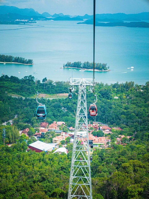
Experience stunning island views and lush greenery from the Langkawi Cable Car in Malaysia
We had planned to take the cable car—the SkyCab that rises up Gunung Machinchang, offering views across the archipelago and toward Tarutao. But we had inadvertently chosen Malaysia Day for our visit, and the queue stretched in a serpentine mass of thousands, visitors from across the country celebrating their national day on an island that is, in every sense, a national treasure. We looked at the line. We looked at each other. We drove on.
I don’t regret it. The cable car will be there next time. What we found instead—the quiet roads, the waterfall, the beach with its view of another country—felt more in keeping with the spirit of the Geopark itself.
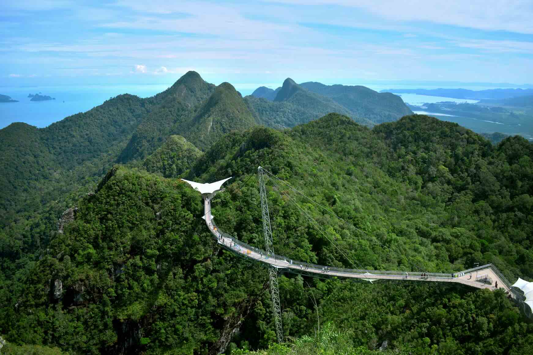
Langkawi SkyBridge
This isn’t a place designed for queues. It’s a place designed for wandering, for looking, for understanding that the ground beneath you holds memory older than anything you can imagine.
Obit the Trilobite and the Lessons of the Geopark
The Geopark’s mascot is a trilobite named Obit—a nod to the ancient marine arthropods that thrived in Earth’s oceans for nearly 300 million years before their extinction. Leonardo liked Obit. He liked the idea that this island was once underwater, that the rocks he was walking on were formed when creatures like Obit swam above them. It made him feel small, he said. But in a good way.
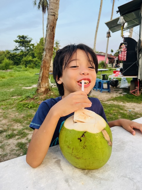
A coconut break on the way back to Kuah
That’s what the Langkawi Geopark does, if you let it. It makes you feel small in the best possible way—not diminished, but connected. To deep time. To the slow drift of continents. To the patient work of water and wind and centuries. While the main town of Kuah, with its commercial buzz and lack of a real beach, may not be to everyone’s taste, the Geopark—the 550-million-year-old archipelago—is something else entirely.
We drove back toward our hotel in Kuah in the late afternoon, the sun beginning its descent. Leonardo was quiet in the back seat, still damp from the waterfall, a small smile on his face. Then, from nowhere: “Papa, can we come back when I’m bigger? I want to see go on the cable car.”
Yes, I told him. We’ll come back. The island will still be here. It’s been here a very long time.
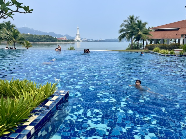
Leonardo swimming at our Kuah hotel
Practical Notes for Families:
-
Temurun Waterfall: Located on Jalan Datai, open roughly 7am–7pm, no entrance fee. The walk to the falls is short but steep, with uneven steps—wear proper shoes, especially after rain. The water is cold but swimmable; bring a towel and a change of clothes for the kids.
-
Pasir Tengkorak (Skull Beach): On the road toward Datai, quiet and shaded, with views across to Koh Tarutao in Thailand. Best visited outside peak hours; facilities are limited.
-
Langkawi SkyCab: The cable car offers access to Gunung Machinchang and the SkyBridge. Queues can be substantial on weekends, public holidays, and during Malaysian school breaks—early morning arrival is recommended if you want to avoid the worst of the wait. https://panoramalangkawi.com/skycab/
-
Getting Around: A rental car is essential for exploring the Geopark’s dispersed sites at your own pace. The roads are generally good, and the drive itself is part of the experience. We rented our car from the agency at the ferry port.
-
Geopark Information: For maps, geosite information, and context about the UNESCO designation, visit the official Langkawi Geopark website: https://www.langkawigeopark.com.my/


