
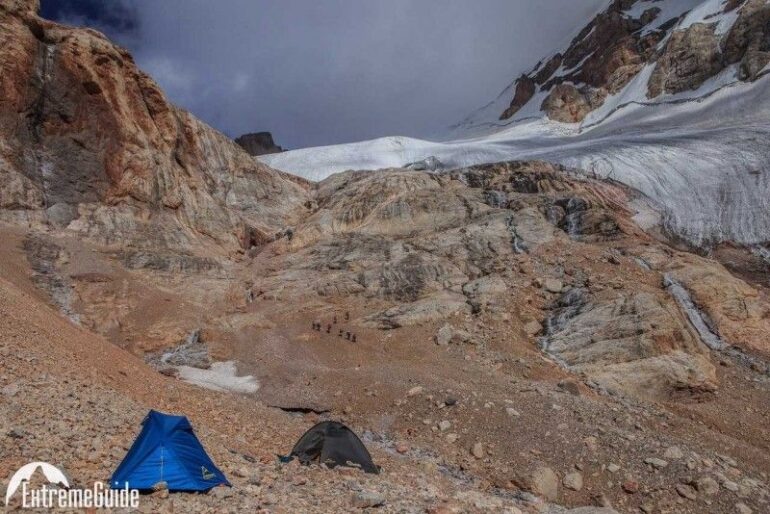
The Pamir Mountains are the kind of place where the scale of the landscape becomes clear only after a few hours on the road. Villages sit far apart, brown and red slopes rise above wide valleys, and snow remains on high ridges even when the lower valleys are already warm. In Tajikistan, the Pamirs feel remote without being completely inaccessible, which is part of their appeal for experienced hikers.
Most journeys into the region begin in Dushanbe, followed by a long drive east towards the mountains. The scenery changes gradually: orchards and green valleys give way to drier slopes, rocky gorges and high-altitude plateaus. Once the road reaches the Pamirs, travelling itself becomes part of the adventure.
Along the Pamir valleys
One of the best ways to experience the region is to combine hiking with a road journey through the Pamir Highway. The route passes through settlements where traditional houses, small fields and herds of sheep stand in sharp contrast to the enormous mountains around them.
The terrain varies considerably. Some walks follow relatively gentle valley floors, while others climb towards mountain passes and alpine lakes. In the higher areas, there may be little shade and almost no vegetation beyond tough grasses and small mountain plants. A short distance on the map can therefore take much longer than expected.
For travellers planning a dedicated mountain trip, the Trekking in the Pamir Mountains guide is a useful starting point for exploring the possibilities of hiking in this region. More information about routes and organised mountain adventures can be found through the ExtremeGuide Team.
The Fann Mountains and the Pamir gateway
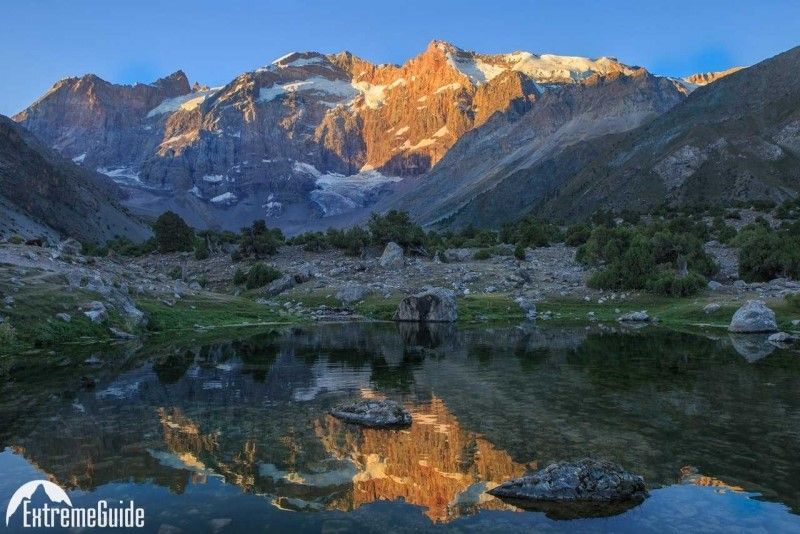 The approach to the Pamirs can be combined with time in the Fann Mountains, west of Dushanbe. This area is known for steep granite peaks, clear lakes and valleys that are easier to reach than some of the more remote Pamir routes.
Seven Lakes is one of the better-known places to explore on foot. The lakes appear one after another along a narrow valley, with trails and rough roads connecting small settlements. In summer, the contrast between the deep blue water and the dry mountain slopes is especially striking.
Further east, the landscape becomes more austere. Near the town of Murghab, trees almost disappear, the valleys become broad and barren, and the mountains seem to stretch without a clear end. At around 3,600 metres above sea level, even ordinary walking can feel noticeably harder.
High-altitude hiking near Murghab
Murghab is a natural base for exploring the eastern Pamirs. The town itself is small, with low buildings spread across an open plateau and mountains visible in every direction.
From here, hikes can lead towards high passes, remote valleys and mountain lakes. Karakul Lake is another memorable stop. Sitting at roughly 3,900 metres, it is surrounded by stark, almost lunar terrain. On a calm day, the water reflects the surrounding peaks; when the wind rises, the lake quickly turns into a sheet of whitecaps.
Altitude is one of the main differences between hiking in the Pamirs and trekking in lower mountain ranges. The thin air is noticeable when climbing even a modest slope, so acclimatisation is not something to leave until the last moment. Slow mornings, shorter walks at first and plenty of time to adjust can make a substantial difference.
A landscape shaped by distance
 What makes the Pamirs unusual is not simply the height of the mountains. It is the amount of open space between them.
A trail can cross a valley for hours without passing another hiker. A shepherd may appear in the distance with a flock of animals, or a small settlement may come into view after a bend in the road. Nights are often exceptionally quiet, with little artificial light and a sky full of stars.
The cultural side of the journey is just as important. In Pamiri villages, travellers may be invited into traditional homes for tea and food. A simple meal, a warm room and a conversation with a local family can become one of the strongest memories of a trip that is otherwise dominated by huge landscapes.
The Pamirs reward travellers who are comfortable with slower journeys and changing plans. Roads can be rough, weather can shift quickly at altitude, and distances that look short on a map can take most of a day. But that sense of remoteness is exactly what gives hiking here its character.
By the time the mountains begin to recede and the road heads back towards lower valleys, the Pamirs leave a particular impression: long stretches of empty road, cold wind coming off the passes, brightly coloured village houses and enormous ridgelines disappearing into the distance. It is a mountain landscape that feels less like a destination to be ticked off and more like a place to spend time in.


